Showing posts with label creek. Show all posts

Wednesday, 24 June 2026

WINTER BY THE CREEK

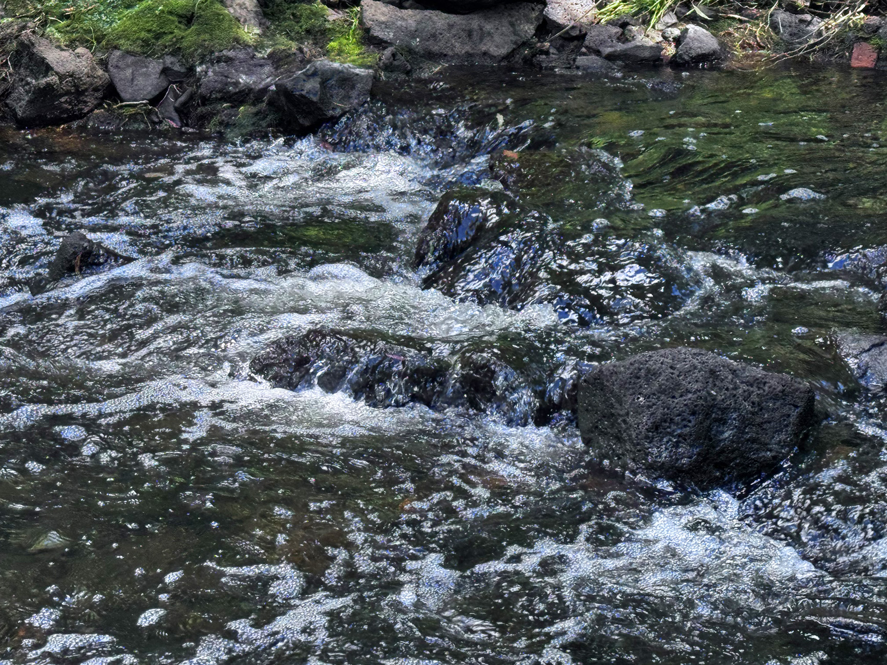
At Darebin Parklands, where the creek flows all through the year. We haven;t had much rain lately so the water level is down. We are expecting a short, mild Winter and a hot dry Summer this year. The results of a strong El NiƱo system, the meteorologists tell us.

This post is part of the Roentare’s Water Meme
and also part of the Nature Notes meme


Wednesday, 10 June 2026

DAREBIN CREEK

This post is part of the Roentare’s Water Meme

and also part of the Nature Notes meme

After some rain, the Darebin Creek in the Darebin Parklands swells and the little footbridge goes underwater. Quite a lot of debris carries by the swollen creek lodges across the bridge, as the large tree branches that you can see behind the bridge.

Wednesday, 13 May 2026

DUCK AND CREEK

A Pacific Black Duck (Anas superciliosa), a common and adaptable dabbling duck found throughout Australia, New Zealand, and surrounding islands.They are identified by their mottled dark brown plumage and a characteristic head pattern featuring a dark brown line through the eye, bordered by cream stripes above and below.Their diet is largely vegetarian, consisting of seeds from aquatic plants, but they also consume aquatic insects, crustaceans, and mollusks.

These ducks are widespread in Melbourne's creek and river habitats, in this particular instance, at the Darebin Parklands, through which flows the Darebin Creek. A quite clean and unpolluted waterway, home to many native species of flora and fauna.

This post is part of the Roentare’s Water Meme
and also part of the Nature Notes meme


Tuesday, 28 April 2026

DAREBIN CREEK

Darebin Creek is a waterway that runs through the northern suburbs of Melbourne, Victoria, Australia. It is the main watercourse of the Darebin Valley and a major tributary of the Yarra River. For tens of thousands of years it was used as a food and tool source sustainably by the Wurundjeri people, Indigenous Australians of the Kulin nation alliance, who spoke variations of the Woiwurrung language group.

The creek rises on the northern urban fringe of Melbourne north of the suburb of Epping, following a general southerly route and meeting the Yarra at Alphington. The creek forms much of the municipal boundary between the City of Darebin and City of Banyule. Formerly an intermittent stream, increased stormwater runoff with urbanisation of the Darebin Creek catchment has resulted in permanent water flow. 

The creek runs through Darebin Parklands, a large nature reserve one or two kilometres northwest of the junction at which the creek meets the Yarra. The Darebin Creek Trail runs along the banks in the lower reaches of the creek. This is the creek at the Darebin Parklands in Fairfield.

This post is part of the Travel Tuesday meme,
and also part of the Roentare’s Water Meme,
and also part of the Nature Notes meme.


Wednesday, 4 February 2026

MERRI CREEK

The Merri Creek is a waterway in southern parts of Victoria, Australia which flows through the northern suburbs of Melbourne. It begins in Wallan north of Melbourne and flows south for 70 km until it joins the Yarra River at Dights Falls. The area where the creek meets the river was traditionally the location for large gatherings of the Wurundjeri people and is suspected to have been the location for one of the earliest land treaties in Australia between Indigenous Australians and European settlers.

The photo is Merri Creek at Clifton HIll, along the Merri Creek Trail. This trail is a 21 km shared use path for cyclists and pedestrians that follows the Merri Creek through the northern suburbs of Melbourne. It makes for a pleasant walk along the creek and one can pretend that one is walking in the wilderness, while still in the heart of the City!

This post is part of the Roentare’s Water Meme
and also part of the Wordless Wednesday meme
and also part of the Nature Notes meme


Wednesday, 21 January 2026

CREEK IN SUMMER

The Darebin Creek in Preston, at the Darebin Forest Park. Another much needed natural bushland area in the middle of suburbia.

This post is part of the Roentare’s Water Meme
and also part of the Wordless Wednesday meme
and also part of the Nature Notes meme


Tuesday, 13 January 2026

BEAUTY HIDES DANGER

Walking along the Darebin Creek in Thornbury, an inner suburb, one can enjoy the natural beauty of the bush in the midst of the City. However, in Summer especially, there may be some untoward encounters, such as meeting this Tiger Snake.

The Tiger Snake (Notechis scutatus) is a large and highly venomous snake of southern Australia, including its coastal islands and Tasmania. These snakes are often observed and locally well known by their banding, black and yellow like a tiger, although the species can be highly variable in colouration and patterning. All populations are classified within the genus Notechis (Elapidae). Their diverse characteristics have been classified either as distinct species or by subspecies and regional variation. While tiger snakes are usually ground-dwelling, they are able to swim as well as climb into trees and buildings.

This post is part of the Travel Tuesday meme
and also part of the Saturday Critters meme


Wednesday, 7 January 2026

DAREBIN CREEK

Fish ladder in the Darebin Creek, at Darebin Parklands, Alphington. A fish ladder, also known as a fishway, fish pass, fish steps, or fish cannon, is a structure on or around artificial and natural barriers (such as dams, locks and waterfalls) to facilitate diadromous fishes' natural migration as well as movements of potamodromous species.

Most fishways enable fish to pass around the barriers by swimming and leaping up a series of relatively low steps (hence the term ladder) into the waters on the other side. The velocity of water falling over the steps has to be great enough to attract the fish to the ladder, but it cannot be so great that it washes fish back downstream or exhausts them to the point of inability to continue their journey upriver. 

This post is part of the Roentare’s Water Meme
and also part of the Wordless Wednesday meme
and also part of the Nature Notes meme.

Wednesday, 20 August 2025

DAREBIN CREEK

Fish ladder on the Darebin Creek at the Darebin Parklands in Alphington. An important conservation area for native flora and fauna.

This post is part of the Roentare’s Water Meme,
and also part of the Wordless Wednesday meme,
and also part of the Nature Notes meme.


Wednesday, 23 July 2025

DAREBIN CREEK

Darebin Creek, seen here flowing through the Darebin Parklands is Alphington, is a perennial creek. Along it are various nature reserves, parks and parklands, providing a welcome green belt running through suburbia. The creek joins the Yarra River further downstream. As well as much native fauna and flora found growing in its banks, there are also some introduced species, for example the Call lily "GreenGoddess" seen in the bottom left corner of the photo. There are concerted efforts to remove as much as possible of the weeds and introduced species and allow the native flora to grow again along the course of the waterway.

This post is part of the Roentare’s Water Meme
and also part of the Wordless Wednesday meme

and also part of the Nature Notes meme


Wednesday, 23 April 2025

EARTH DAY

Earth Day is an annual event on April 22 to demonstrate support for environmental protection. First held on April 22, 1970, it now includes a wide range of events coordinated globally through earthday.org (formerly Earth Day Network) including 1 billion people in more than 193 countries.

The Darebin Parklands is a nature conservation area and educational facility that includes recreational and research areas relating to the environment. It is situated around the Darebin Creek, which flows into the Yarra River, and is a much-beloved green space amongst typical metropolitan suburbia. It is about 7 km NE of the Melbourne City Centre.

This post is part of the Roentare’s Water Meme,
and also part of the Wordless Wednesday meme,
and also part of the Nature Notes meme.


Wednesday, 19 February 2025

FISH LADDER

Fish ladder in the Darebin Creek, at Darebin Parklands, Alphington.

A fish ladder, also known as a fishway, fish pass, fish steps, or fish cannon, is a structure on or around artificial and natural barriers (such as dams, locks and waterfalls) to facilitate diadromous fishes' natural migration as well as movements of potamodromous species. Most fishways enable fish to pass around the barriers by swimming and leaping up a series of relatively low steps (hence the term ladder) into the waters on the other side. The velocity of water falling over the steps has to be great enough to attract the fish to the ladder, but it cannot be so great that it washes fish back downstream or exhausts them to the point of inability to continue their journey upriver.

This post is part of the Roentare’s Water Meme

and also part of the Wordless Wednesday meme

and also part of the Nature Notes meme


Wednesday, 5 February 2025

MORDIALLOC

Mordialloc is a beachside suburb in Melbourne, Victoria, Australia, 24 km south-east of Melbourne's Central Business District, located within the City of Kingston local government area. Mordialloc recorded a population of 8,886 at the 2021 census.

The namesaked Mordialloc Creek (seen here) is arguably the most significant feature of the suburb. Home to Pompei's boat works, Mordialloc Creek has a rich history of traditional wooden boat building. Many classic boats line the banks of the creek. The creek mouth section below Nepean Highway is also home to the Mordialloc Motor Yacht Club and Mordialloc Sailing Club, and the creek drains into the Beaumaris Bay flanked by the Mordialloc Pier.

This post is part of the Roentare’s Water Meme

and also part of the Wordless Wednesday meme

and also part of the Nature Notes meme


Wednesday, 22 January 2025

MERRI CREEK IN SUMMER

Merri Creek is a waterway in southern parts of Victoria, Australia which flows through the northern suburbs of Melbourne. It begins in Wallan north of Melbourne and flows south for 70 km until it joins the Yarra River at Dights Falls.

The area where the creek meets the river was traditionally the location for large gatherings of the Wurundjeri people and is suspected to have been the location for one of the earliest land treaties in Australia between Indigenous Australians and European settlers.

This is Merri Creek at Clifton HIll, along the Merri Creek Trail. This is a 21 km shared use path for cyclists and pedestrians that follows the Merri Creek through the northern suburbs of Melbourne. It makes for a pleasant walk along the creek and one can pretend that one is walking in the wilderness, while still in the heart of the City!

This post is part of the Roentare’s Water Meme,
and also part of the Wordless Wednesday meme,
and also part of the Nature Notes meme.


Wednesday, 25 September 2024

DAREBIN CREEK

One of the lovely spots in the Darebin Parklands in the midst of metropolitan Melbourne.

This post is part of the Roentare’s Water Meme,
and also part of the Wordless Wednesday meme,
and also part of the Nature Notes meme.